
Schaumburg ZIP Directory Coverage
Current Postal Bulletin material pairs five ZIP labels with Schaumburg. That evidence confirms accepted city and ZIP wording, but it does not draw parcel boundaries or prove that every address lies inside the incorporated village. USPS address lookup remains the proper check for one delivery point. County GIS then shows the parcel, municipality, township, and other legal geography.
| ZIP Code | Areas Covered | Post Office | Notes |
|---|---|---|---|
| 60173 | Schaumburg label; Woodfield and central commercial association | Woodfield Finance Station | Exact delivery and village boundary must be checked by address |
| 60193 | Current Schaumburg postal label | No separate station found in inspected sources | Official neighborhood and county limits were not located |
| 60194 | Schaumburg label; central and civic association | Schaumburg Post Office | The station address is evidence, not a ZIP polygon |
| 60195 | Current Schaumburg postal label | No separate station found in inspected sources | Delivery area and special-use status require address verification |
| 60196 | Current Schaumburg postal label | No separate station found in inspected sources | Delivery area and special-use status were not established |
Do not assign unsupported neighborhood names or special-purpose status to the last two codes. The official sources did not provide exact polygons, per-ZIP population, voter counts, or a parcel-by-parcel city-line crosswalk. A sound ZIP code directory says where evidence ends. Nearby Hoffman Estates and Roselle postal labels can add confusion, especially in older records.
Search Schaumburg Postal Fields
The USPS ZIP Lookup has three useful paths: a full address, a city and state, or cities associated with a ZIP. A result standardizes mailing form. USPS warns that it does not confirm that a person or company is present at the address.
| Search path | Field | Requirement |
|---|---|---|
| By Address | Company | Optional |
| By Address | Street address | Required |
| By Address | Apartment, suite or other unit | Optional |
| By Address | City and state | Required |
| By Address | ZIP | Optional narrowing field |
| By City and State | City and state | Required |
| Cities by ZIP | ZIP | Required |
The USPS AIS Viewer links address-quality products for city and state, county, delivery statistics, ZIP+4, and address lookup.
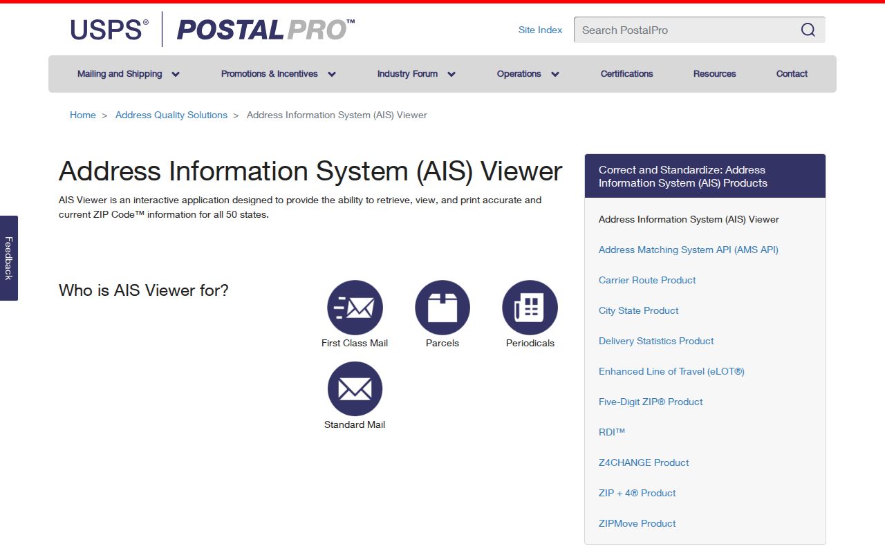
The captured viewer shows that ZIP and ZIP+4 products belong to an address-quality system rather than a directory of named residents.
Current Schaumburg ZIP Labels
The current Postal Bulletin supports the Schaumburg labels used in the coverage table. It is a dated source, which matters because postal assignments can change. It should be cited with the date and paired with a live address lookup when accuracy for one property matters.
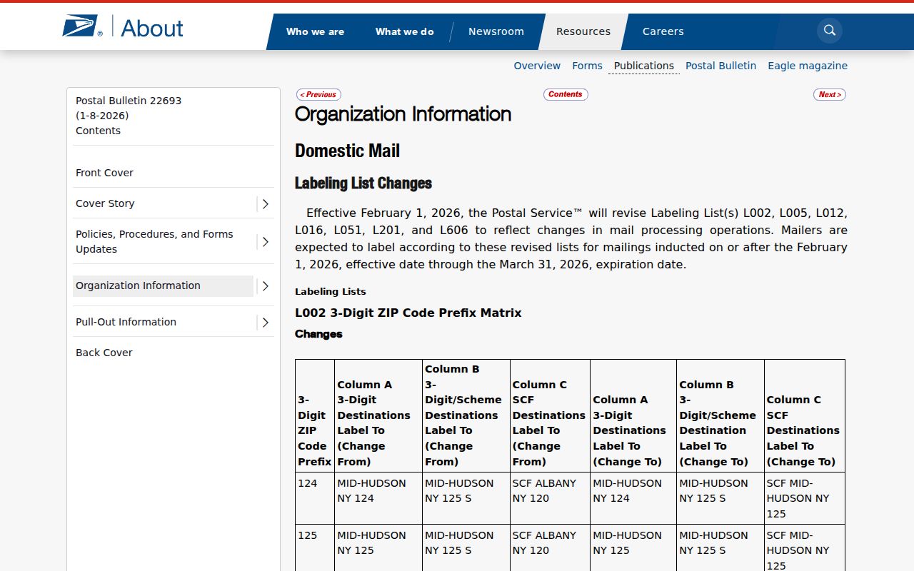
The bulletin capture documents current city-label evidence without claiming an official ZIP boundary map that the source does not supply.
A postal label tells carriers how to route mail. It does not establish incorporation, school district, township, voting district, property ownership, or county custody. Those answers require village, election, assessor, recorder, or GIS records.
Note: Record the bulletin or lookup date, since an old directory can preserve a valid label that is no longer current.
Schaumburg ZIP Postal Stations
Two official station pages give useful local anchors. The Schaumburg Post Office is at 450 W Schaumburg Road with the 60194-9998 station ZIP and phone 847-885-6501. The Woodfield Finance Station is at 1951 McConnor Parkway with the 60173-9987 station ZIP. Their pages provide current services and hours.
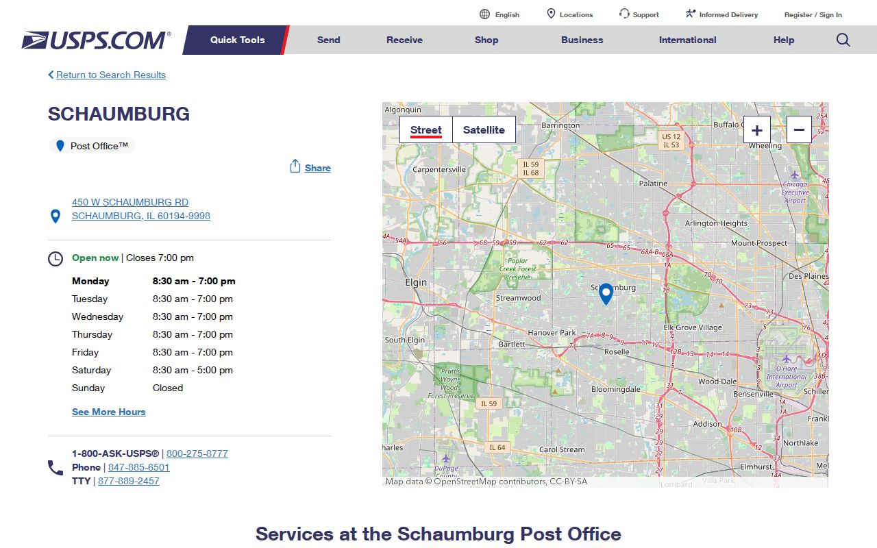
The Schaumburg Post Office page supports the 60194 station association, but the building's ZIP does not define the full delivery area.
The Woodfield station provides a second local point of reference for the commercial district.
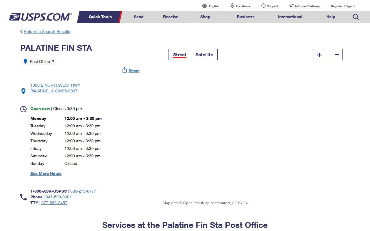
Together, the stations explain why a postal directory can use service locations as evidence while still requiring address-by-address verification.
Find Schaumburg Residents by ZIP
Most local record systems do not offer a ZIP-wide roster. The Illinois voter status tool uses a five-digit ZIP to check a known person and then populate street choices. It does not reveal all voters in that code. Cook's basic assessor address search lacks a ZIP field. DuPage Election Search uses house number, street, direction, suffix, and city. County parcel viewers rely on address, PIN, intersection, map selection, or shapes.
- Enter the full address in USPS ZIP Lookup. Save the standardized city, state, ZIP, and unit form.
- Identify the parcel in CookViewer or DuPage Parcel Viewer. Confirm municipality, county, PIN, and the physical property address.
- Open the proper county assessor or property portal. Search by exact address or PIN, not by an assumed ZIP-wide filter.
- If checking voter status with the person's consent and needed details, use the official state or county tool. Do not retain sensitive input.
- When the task narrows to one road, follow the Schaumburg street directory method for parcel-by-parcel public evidence.
This workflow keeps postal, parcel, and person records in their proper roles. A property result may show an owner label but not all occupants. A voter tool checks supplied details but does not publish a block list. No result can mean the wrong county, spelling, unit, date, or coverage rather than absence from Schaumburg.
Schaumburg ZIP Search Limits
The portal differences are easy to miss. Cook Treasurer accepts an optional ZIP only after street and city fields. Cook Assessor's advanced form uses address ranges, township, class, and other parcel fields, but no simple observed ZIP filter. DuPage Property Lookup provides PIN, address, real-property name, map, tax, and appeal routes. Its ZIP filter was not located. GIS selection finds geographic parcels, not every mailing address assigned to a code.
| System | Observed ZIP use | What comes back |
|---|---|---|
| USPS ZIP Lookup | Core address or ZIP search | Standardized postal result, not person confirmation |
| Illinois voter status | Required for a known-person check | Status based on supplied details, not a roster |
| Cook Treasurer | Optional with address | One parcel's tax account and history |
| Cook Assessor | No simple ZIP field observed | Address, PIN, neighborhood or advanced parcel results |
| DuPage elections | No ZIP field observed | Name, address or district search |
| CookViewer and DuPage GIS | Map and parcel tools | Selected geographic parcels, not a postal resident list |
Illinois voter-file access also carries legal limits and protected fields. A directory should not turn an authorized political-purpose file into a household list. For general public research, use the status form only for a known person with the needed details and a lawful reason.
Schaumburg ZIP History Since 2006
Postal geography changes. A 2006 Postal Bulletin states that part of the delivery area then using 60173 changed to 60169 with Hoffman Estates as the preferred city name, effective July 1, 2006. That realignment is a practical warning for old resident records. A valid old address may fail a current search if its historic city and ZIP wording are replaced too soon.
Older references to 60159 or 60168 also need date checks. They are historical or alternate postal evidence, not codes that should be added to the current Schaumburg ZIP code directory without a current USPS result. Roselle 60172 and Hoffman Estates 60169 can appear near Schaumburg routes. Search the date-appropriate form first, then match the parcel through its PIN, subdivision, lot, block, and adjacent roads.
This geography is especially useful for family history. A directory entry, school record, obituary, or old phone book may retain the label in force when it was printed. Keep that wording in the citation even if today's standardized address differs.
Schaumburg ZIP Geography Changed
Schaumburg grew from a rural center into subdivisions, industrial parks, and a regional commercial hub. Olde Schaumburg Centre, Fenz's Acres and Long Avenue, Weathersfield, Spectrum Industrial Park, and the Woodfield area arose in different record eras. Later rail, airport, road, and annexation changes added more layers. Postal labels, plats, permits, village limits, and tax parcels therefore do not align as one simple map.
Near Olde Schaumburg Centre, historic locality names and township records may be stronger than a modern ZIP search. A Weathersfield address may connect more clearly through a subdivision plat. Woodfield-area research may depend on commercial parcels, permits, and station verification. Use the ZIP to standardize mail, then let the parcel and record date choose the archive.
No official parcel-by-parcel list of every city-line mismatch was found. That gap should remain visible. It is safer than assigning a neighborhood, county, or resident to a ZIP based on an unofficial map.
Schaumburg ZIPs Versus Village Limits
A Schaumburg city label describes postal routing. Incorporated village limits describe municipal jurisdiction. Cook and DuPage parcel lines identify county custody, while townships, school districts, election precincts, and neighborhoods each have their own boundaries. One address can sit in several different geographies at once. Never use the ZIP alone to decide which assessor, recorder, clerk, or court holds the record.
Verify a delivery address with USPS, then inspect the parcel in CookViewer or DuPage Parcel Viewer. Compare municipality, PIN, legal description, and district layers. When old and new address forms conflict, preserve both and add the effective date. The legal description can bridge a change that the street or postal label cannot.
- ZIP
- A five-digit postal code used to route mail to an area or delivery operation.
- ZIP+4
- The basic ZIP plus four digits that narrow delivery to a segment, building, unit group, or box group.
- PO-box ZIP
- A ZIP assigned chiefly to post-office boxes. No Schaumburg code was confirmed as box-only in the inspected sources.
- Unique ZIP
- A code assigned to one organization with enough mail volume. No Schaumburg unique-code status was confirmed.
- Carrier route
- A postal delivery path within a ZIP. It is not the same as a village ward or parcel boundary.
Boundary check. A Schaumburg ZIP code directory narrows postal geography. Only the official parcel and municipal sources establish county and village jurisdiction.