
Walk a Schaumburg Street
A sound street-by-street search moves from land to names, not the other way around. Copy the street number, direction, unit, city label, and date being researched. Locate the parcel in CookViewer or the DuPage Parcel Viewer and save its PIN, the county parcel identification number. The map establishes which county system applies and helps distinguish nearby lots with similar addresses.
The next records describe different ties to the address. An assessor card can name an owner and physical features. A deed identifies parties to a transfer. A voter tool tests a known person, while a reverse directory gives a dated telephone subscriber or occupant clue. Keep those meanings separate.
- Confirm the parcel and county in the county GIS viewer.
- Open the assessor card and record the situs address, PIN, and legal description.
- Follow the PIN or legal description into the correct recorder index.
- Test a known name in an official voter tool, when appropriate.
- Use a year-specific reverse directory for a historical address clue.
This Schaumburg street directory method produces a dated chain that another researcher can check, rather than an unsupported household roster.
Search Schaumburg Streets in Cook
The Cook County Assessor address search separates house number, direction, street, unit, and city. Its instructions say to omit suffixes such as Avenue or Street from the street-name field. A CAPTCHA is required. PIN lookup uses fourteen digits. Advanced search can accept address and unit ranges, township, property class, and a partial PIN of at least eight digits.
| Cook route | Fields | Street use |
|---|---|---|
| Address | Number, direction, street, unit, city | Find one parcel |
| PIN | 14-digit PIN | Return to a known parcel |
| Advanced | Range, township, class, partial PIN | Narrow a segment |
| CookViewer | Address, intersection, PIN, selection | Inspect nearby parcels |
The parcel card can show class, neighborhood, tax code, assessed values, building traits, exemptions, appeals, and correction history. An exemption may support an owner-occupancy inference, but it does not name everyone at the address.
The manifest capture shows the Cook advanced property form.
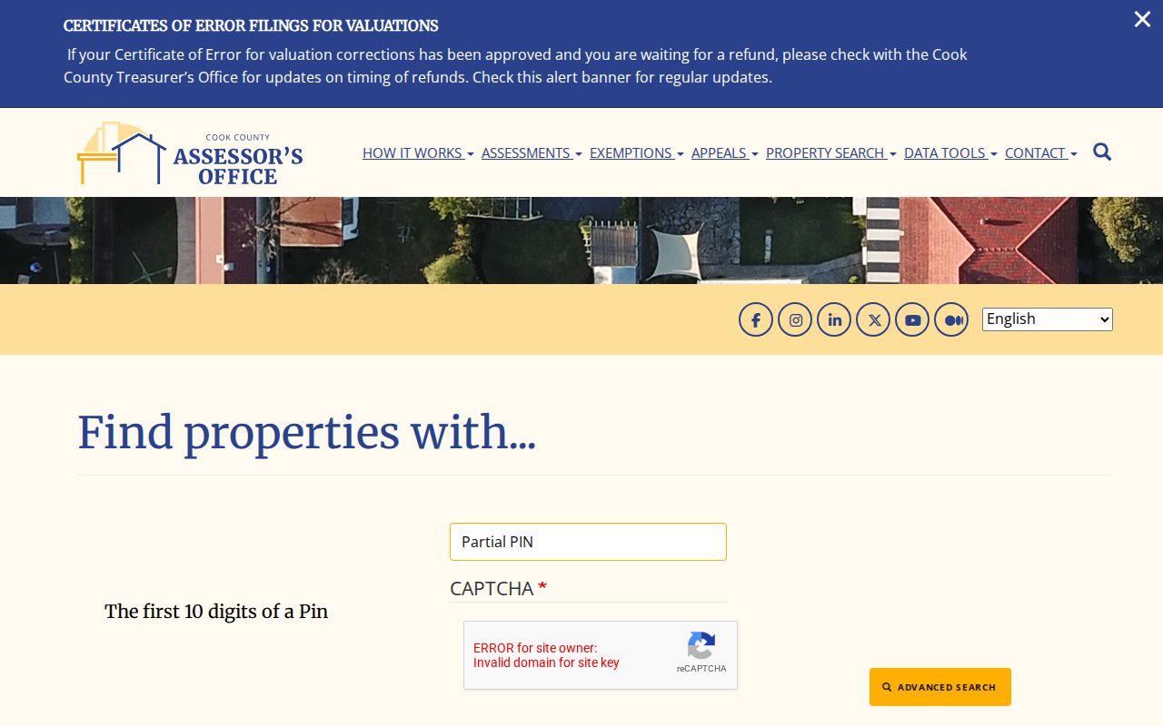
Its range and township fields help when one exact spelling returns no parcel.
Map Schaumburg Streets in CookViewer
CookViewer connects an address to map geometry. Search modes include parcel, PIN, parcel-address locator, address locator, and intersection. Click selection handles one lot. Rectangle and polygon selection can collect a small stretch of a block. Property Results returns PIN and address entries, and detail links lead toward assessor, clerk, and tax records.
The map supplies township, municipality, zoning, class, neighborhood, land area, building age, imagery, and district context. Those layers describe land and public districts. They do not prove that a map label is a current owner or occupant.
The official CookViewer source appears below.
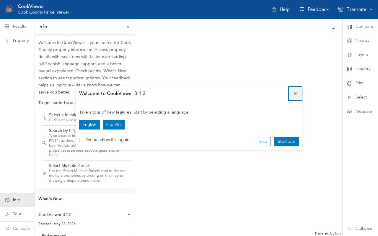
The viewer works best as a parcel-selection tool before each result is checked in the underlying county record.
The Cook property tax search adds five years of original billed history through PIN or address. Street and city are required; unit and ZIP are optional. Tax history dates a parcel account, not a household.
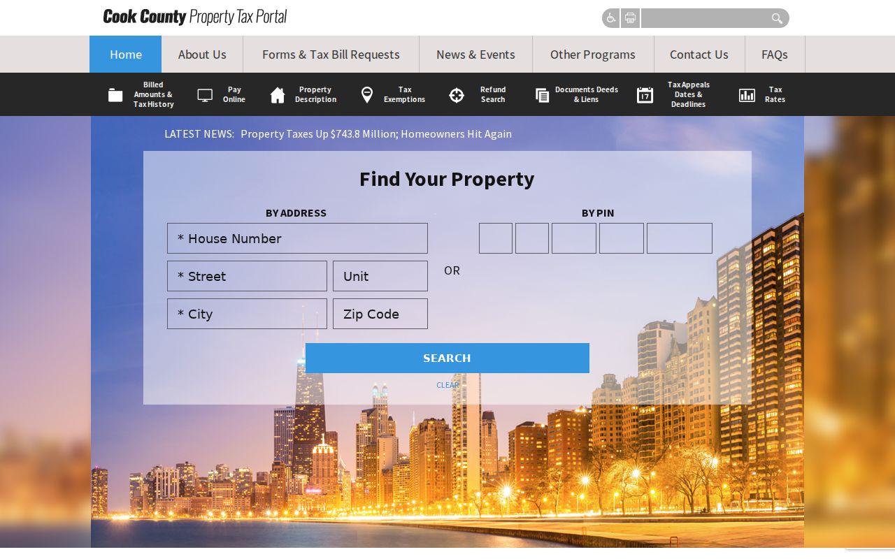
This tax screen gives a second county check when an assessor result must be matched by PIN.
Browse Schaumburg Streets in DuPage
The DuPage side uses a different chain. The DuPage Property Lookup offers PIN, address, real-property or billing-name, map, and tax routes. A result can include owner, street, tax year, taxes, sale date and price, document number, grantor, grantee, recording date, legal description, map, transfer history, exemptions, appeals, and split or combine history.
The source warns that the last certified assessment can change and prohibits data mining. Work parcel by parcel. The image below comes from the DuPage property lookup.
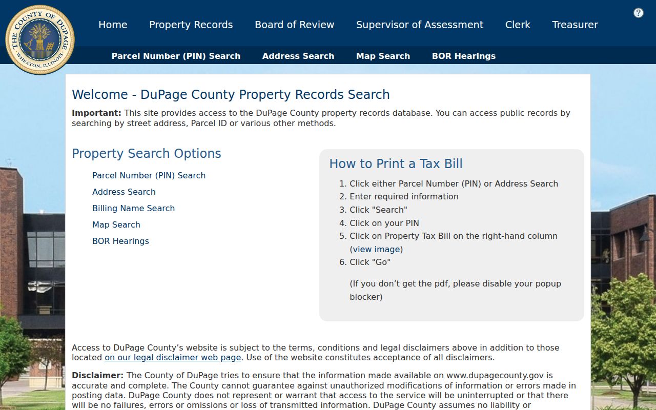
Its separate paths help resolve an address even when a name or tax-bill route is the stronger start.
The DuPage Parcel Viewer tutorial documents PIN and address search, map clicks, shape selection, subdivision search, street intersections, measurement, Pictometry imagery, and buffers around selected parcels. A buffer is only a chosen map distance. It is not a legal street, subdivision, or neighborhood boundary.
Deeds Along Schaumburg Streets
Once a PIN and legal description are known, recorded instruments show the parcel chain. Cook recording functions moved from the Recorder of Deeds to the Cook County Clerk on December 7, 2020. Old instructions that name the former office should now lead to Cook County Clerk Recordings. Search deeds, mortgages, releases, liens, easements, and plats only for the role each document proves.
The DuPage Recorder search accepts names, bank or trust, subdivision or business, street, city, PIN, document number, document group or type, and dates. Its online index and images begin March 16, 1961. Office terminals and the recorder research phone are fallback channels when the web search or image does not answer the question.
The captured DuPage Recorder property search shows those field groups.
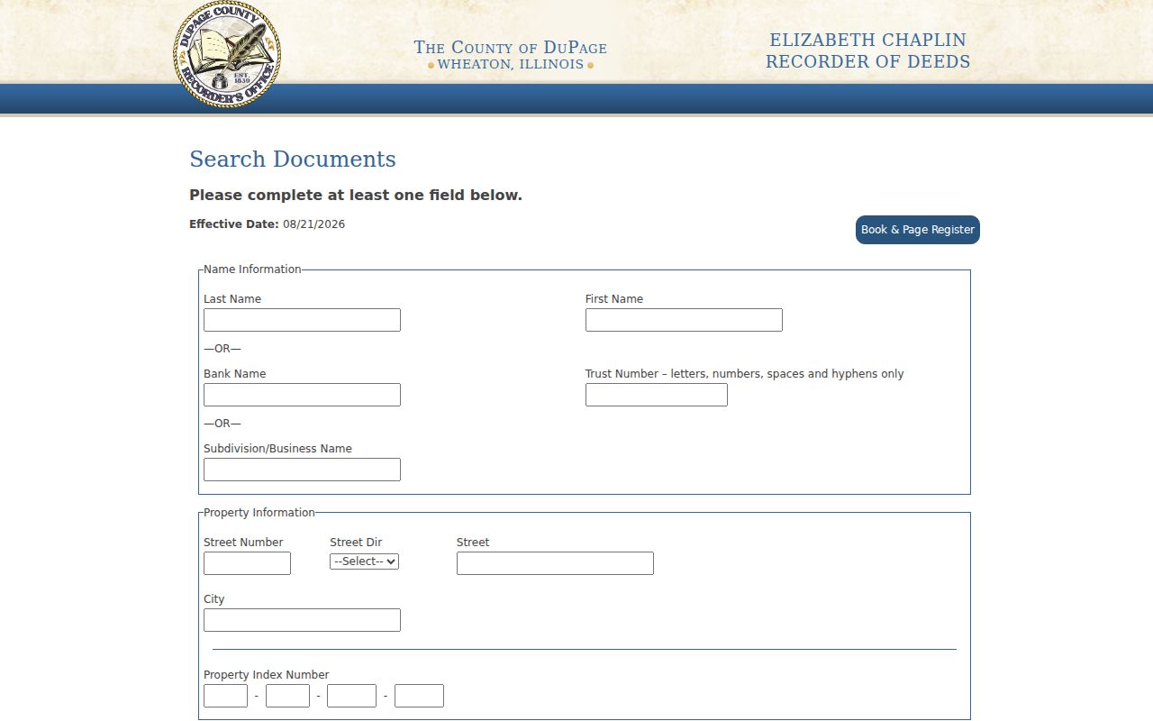
The subdivision and PIN fields can bridge an address whose street label changed while the legal parcel stayed recognizable.
Schaumburg Street Address Terms
Three address forms recur across both counties. Mixing them is a common reason a Schaumburg street directory search points to the wrong parcel.
- Parcel
- A mapped unit of land identified by a county PIN. It may be split, combined, or reassessed.
- Situs address
- The physical location assigned to the parcel or structure. It may differ from the tax mailing address.
- Plat
- A recorded map identifying a subdivision, lots, blocks, streets, and easements.
- Criss-cross directory
- A directory arranged by street and house number rather than only by surname.
The legal description, such as lot and block within a subdivision, often survives a street-number change. The owner mailing address only identifies where correspondence goes. It may be old, outside Schaumburg, or assigned to an organization.
Schaumburg Street Directory Sources
No one source establishes who lives inside every home. The strongest address search compares independent records and states what each supports.
| Source | Evidence | Access | Limit |
|---|---|---|---|
| Assessor and tax | Owner, PIN, values, building facts | Portal; FOIA for deeper data | Owner is not every occupant |
| GIS | Geometry and public districts | County viewer | Labels need verification |
| Recorder | Parties, instrument, legal parcel | Index, terminal, copies | Coverage and fees vary |
| Permits | Project, applicant, public contact | OpenGov, office, FOIA | Applicant may not live there |
| Voter tool | Status for a known query | State or county tool | No open street roster |
| Old directory | Dated subscriber or address clue | Library or scan | Not current proof |
When a portal fails, use the fallback. County offices provide counters, research phones, public terminals, and copy procedures. Village permit and code material may be requested through the Schaumburg FOIA center under the Illinois Freedom of Information Act. Exemptions and redactions apply.
Schaumburg Permits by Street
The Village permit service covers residential, commercial, fire, and express permits, plan or permit-card records, fees, and inspections. A permit may date a remodel or identify an owner, applicant, contractor, or public project contact. Each label is a role in that file, not proof of residence.
Planning and zoning records add subdivision and plat context. Code violations or certificates of occupancy may require FOIA. The research did not establish a full online historical cutoff, so the counter or written request matters when OpenGov has no older result. Record the search date, address spelling, and requested record type.
Note: A missing result can reflect coverage, spelling, a parcel change, or county choice rather than the absence of a record.
Old Schaumburg Streets by Directory
The Schaumburg Library keeps reverse telephone runs that add a historical name to an address. Northwest Suburban Street Address Telephone Directories are held for 2004, 2005, 2007, 2008, and 2009. Haines Chicago Near North Suburban Criss-Cross directories run from 2010 to the present in the documented inventory. Earlier books use locality forms such as Schaumburg Centre and abbreviations such as “Schmbrg Cntr.”
The local shelf has a reported gap for Schaumburg and Hoffman Estates phone books from 1960 through 1981. That is a collection gap, not proof that nobody appeared in a directory. Library staff can check fragile volumes and may provide a narrow page scan. Collection detail belongs in the Schaumburg Directory Book.
Postwar subdivisions changed the address trail. Fenz’s Acres dates to 1948, Weathersfield construction to 1964, and later Woodfield and annexation growth created mixed parcel and postal contexts. No full official street-renumbering table was found. Use the PIN, subdivision, lot, block, nearby roads, maps, and permits to bridge a suspected change.
Limits of Schaumburg Street Records
A public street search cannot reliably identify all household members. Private utility and delivery accounts, protected voter addresses, sealed files, private association rosters, and motor-vehicle addresses remain outside an ordinary lookup. Illinois and federal rules restrict personal address information from motor-vehicle records. Do not guess a person from a vehicle or neighbor’s file.
Postal labels also mislead. A Schaumburg mailing label, incorporated Village line, county parcel, school district, township, and ZIP boundary are different geographies. Verify the address through USPS, then use parcel GIS to choose Cook or DuPage. State whether a name came from ownership, a deed, a permit, a voter check, or a dated directory.
Use public records lawfully. Do not publish a raw street roster or use address records to stalk, harass, intimidate, or harm anyone.
A careful Schaumburg street directory supports family history, parcel research, civic questions, and checking a suspicious deed or permit notice. It stops when a source is private, protected, sealed, or too weak to verify.